| Topology | Info Maps | Info Landscapes | Info Spaces | ISP Maps | Web Site Maps | Surf Maps | Historical ]
| Submarine cables and communications satellites provide the vital infrastructure that wires the world together. Maps are used to plan and manage this infrastructure. |
|
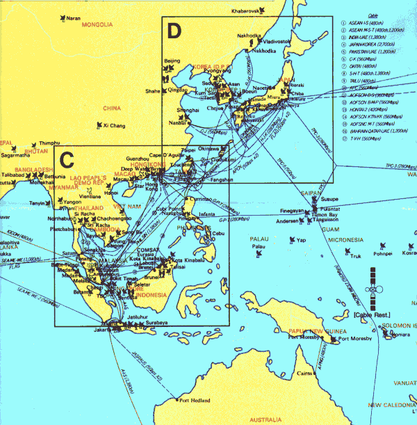
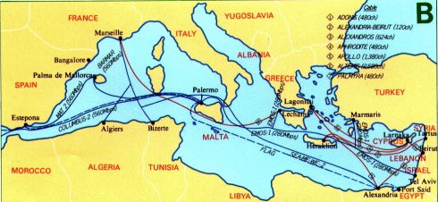
A map from KDD Submarine Cable Systems Inc. showing the submarine cable infrastructure in the Asian region in 1996. A range of maps are available for different regions of the world for 1993, 94 and 96. KDD is a major telecommunications company and its submarine cable division is one of the leading contractors laying and maintaining cables around the world. Below is an another map from KDD showing the cable infrastructure for the Mediterranean region in 1996. |
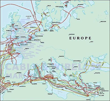 |
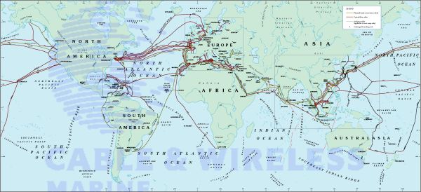
Cable & Wireless Global Marine, a major firm constructing and operating undersea cables, also provides detailed maps of submarine cable infrastructure for different regions of the world. The map on the left shows Europe, while the one below shows the whole globe. |
| The TeleGeography, Inc. research consultancy tracks the geography of submarine telecommunications infrastructure. They publish detailed maps, like the one show opposite. | 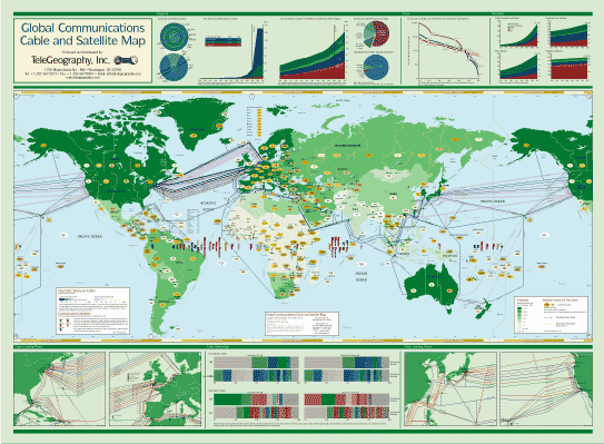 |
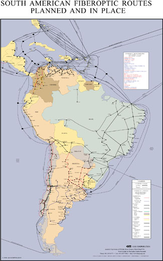 |
KMI Corporation specialises in research on fiberoptic markets and they produce a series of maps of land and submarine cable infrastructure. A small example is on the left. |
|
For further information on submarine cable infrastructure see the comprehensive resource "Submarine Cables of the World WWW Information Page", maintained by the International Cable Protection Committee.
Also, see the article"Mother Earth Mother Board" by Neal Stephenson, from Wired (December 1996) where he looked at the FLAG project. The article "Evolution of a Wired World: the growth of an undersea, international network" by Susan Dumett in Pretext Magazine (March 1998) traces the history of submarine cables. |
|
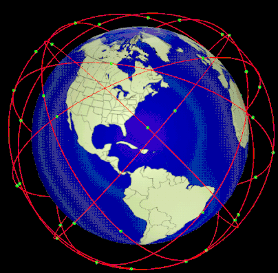
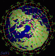
Constellations of satellites, such as the Teledesic system, are being deployed to provide global network infrastructure. The SaVi (satellite visualization) system can visualise the orbital patterns of these satellites as shown in the example images here. SaVi was developed by Robert Thurman and Patrick Worfolk, in The Geometry Center, University of Minnesota.
Click on the image on the right to see an animated version (536KB). There is also an interactive JAVA version available. |
 |