| We present a range of the historical maps of ARPANET, Internet and Usenet, showing how these networks grew and developed from their beginnings in 1970s. |
|
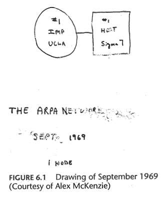
The first node on ARPANET at University California Los Angeles (UCLA) on the 2nd of September 1969. (Source : "Casting the Net", page 55) |
|
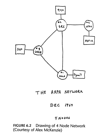
By the end of the year there are four nodes on the "ARPA NETWORK", as shown in schematic above. These were University of California Los Angeles (UCLA), University of California Santa Barbara (UCSB), University of Utah and the Stanford Research Institute (SRI). (Source : "Casting the Net", page 56. See also The Computer Museum Timeline.) |
|
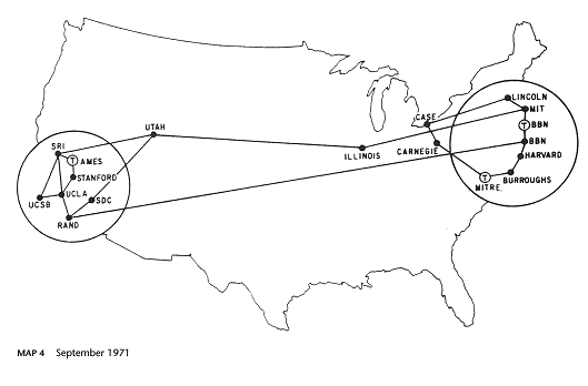
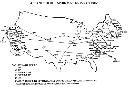
ARPANET grew rapidly as more sites are connected. The map above shows the situation in September 1971 and the one below is from October 1980, which includes a packet satellite link UCL in London. (Sources : "Casting the Net", page 64; CCR, page 93) |
|
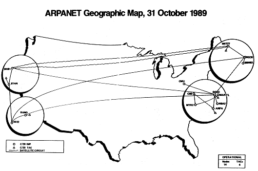
The state of ARPANET in October 1989 near the end of its life with only a few nodes left. It was finally decommissioned in 1990 having been largely replaced by NSFNET.
(Source : CCR, page 110) |
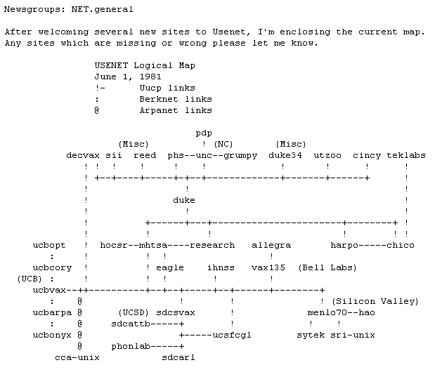
The Usenet in 1981.
The NSFNET infrastructure and topology in 1991.
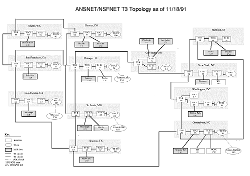
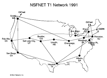
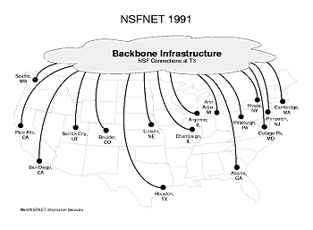
(Source : NSFNET postscript maps from ftp://ftp.uu.net/inet/maps/nsfnet/.)
|
|
|
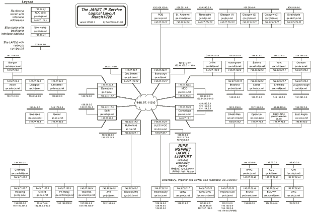
Thanks to Peter H. Salus's book
"Casting the Net : From ARPANET to Internet and beyond...", for providing many of the maps used. ARPANET maps are also taken from an article in Computer Communications Review (CCR), entitled "Selected ARPANET Maps", Vol. 20, October 1990, pages 81-110. Also, thanks to Jon Crowcroft, in UCL's department of computer science, for the JANET maps. |