[ Introduction
| Conceptual
| Artistic
| Geographic
| Cables & Satellites
| Traceroutes
| Census
| Topology
| Info Maps
| Info Landscapes
| Info Spaces
|  ISP Maps
| Web Site Maps
| Surf Maps
| Historical
]
ISP Maps
| Web Site Maps
| Surf Maps
| Historical
]

Maps of Internet Service Provider (ISP)
and Internet Backbone Networks
In this page of the Atlas we present a sample of some of the best network topology maps created by Internet Service Providers (ISPs) and Internet backbone operators. The maps are often created for promotional purposes to demonstrate the large bandwidth and good connections available.

|
|
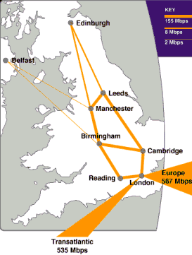
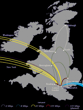
| Maps of UUNET's UK backbone network. The left hand one is taken from February 1999 and the right hand one was from mid 1998. Check their Web site for current details on their network. |
|
|

The topology map above is EUnet's European backbone network, while the figure below focuses on EUnet-Belgium's international network connectivity.
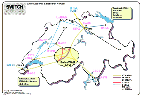
The SWITCH network, the national academic and research network in Switzerland.
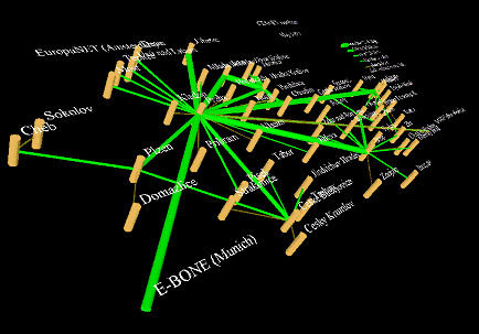
| An interesting 3D VRML map of CESNET - the Czech educational and scientific network. If you have a browser capable of handling VRML files you can download the 3D map yourself and view it from any angle. |
|
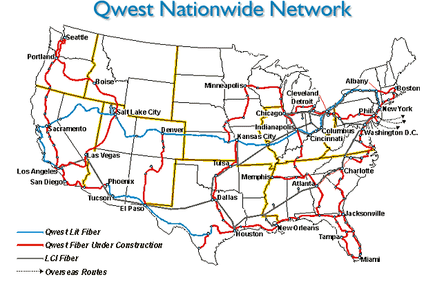
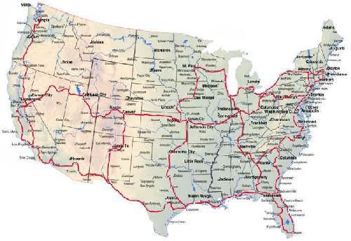
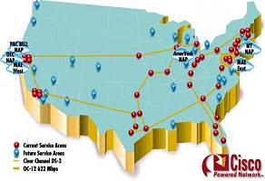
| The backbone network of Qwest for the Northeast of the USA and below the whole country. | 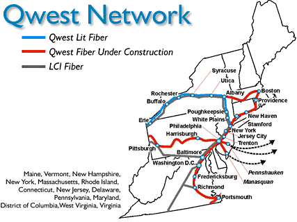 |
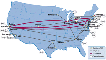
| A map of the Abilene network part of the Internet2 project linking major US universities with a very fast, high-capacity network. |
|
|
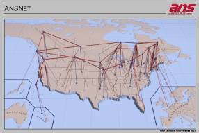
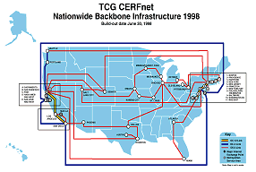
The ANSNet backbone map uses the same three-dimensional graphic metaphor to represent network links as Cox and Patterson used in their NSNET visualisation (shown on the "Geographic" page of this Atlas). The map above right shows TCG CERFnet backbone network, in June 1998, using a stylised "subway" form of cartographic representation.
|
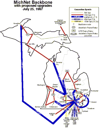
The MichNet backbone in July 1997. MichNet is a regional network serving the Michigan area of the USA and operated by Merit Network Inc. |
Below are backbone network maps for DIGEX and GTE Internetworking, both major players in the Internet infrastructure world.
|
|
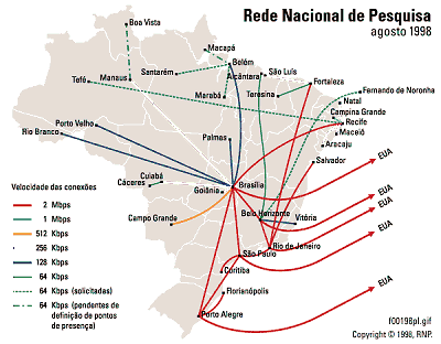
| Map of backbone and international connections for the Rede Nacional de Pesquisa, the nation research network for Brasil. |
![]()
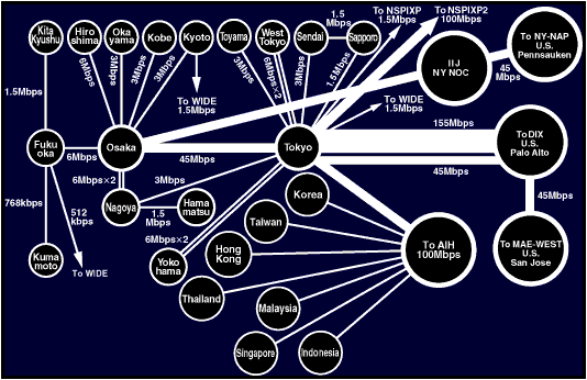
A topology map of the >Internet Initiative Japan (IIJ) backbone, the largest data network in Japan.
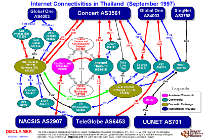
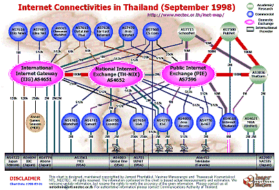
| Excellent diagrammatic 'maps' showing Thailand's Internet Connectivity in September 1997 & 1998, produced by Jumpot Phuritatkul and Thaweesak Koanantakool, NECTEC. |

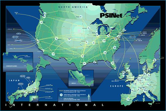
![]() PSINet's global Internet backbone network from March 1999. (See their web site for the latest map)
PSINet's global Internet backbone network from March 1999. (See their web site for the latest map) ![]()
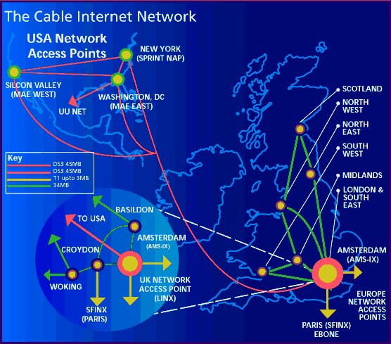
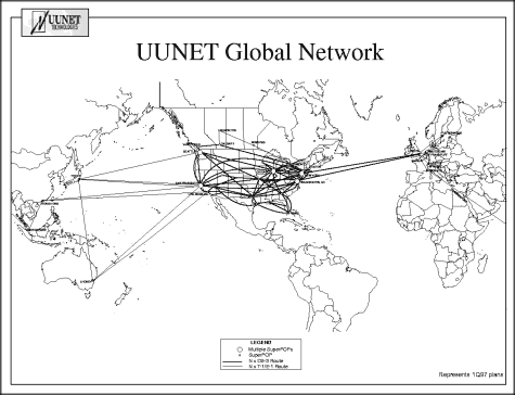
UUNET's global Internet backbone network. (See their web site for the latest map)
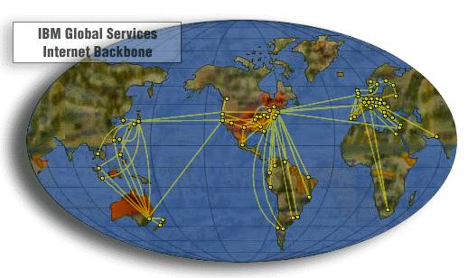
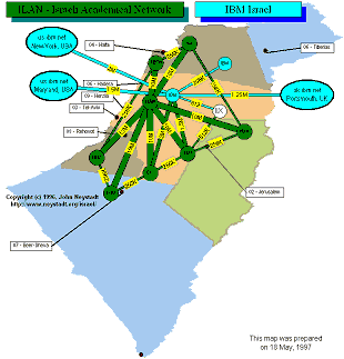
A map of IBM's Global Services Internet backbone.
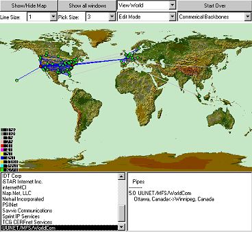
| Mapnet, is a powerful interactive mapping tool with which you can map and examine the Internet backbone infrastructure of over thirty different commercial and research & education ISPs. Mapnet was developed by CAIDA - Cooperative Association for Internet Data Analysis. |
 |
Thanks to Russ Haynal's ISP Page for helping to locate some of the maps shown here.
It should be noted that in the rapidly changing commercial Internet, the backbone maps shown here may not necessarily match the current infrastructure. Please consult the companies web sites for most up to date maps and information on their networks.