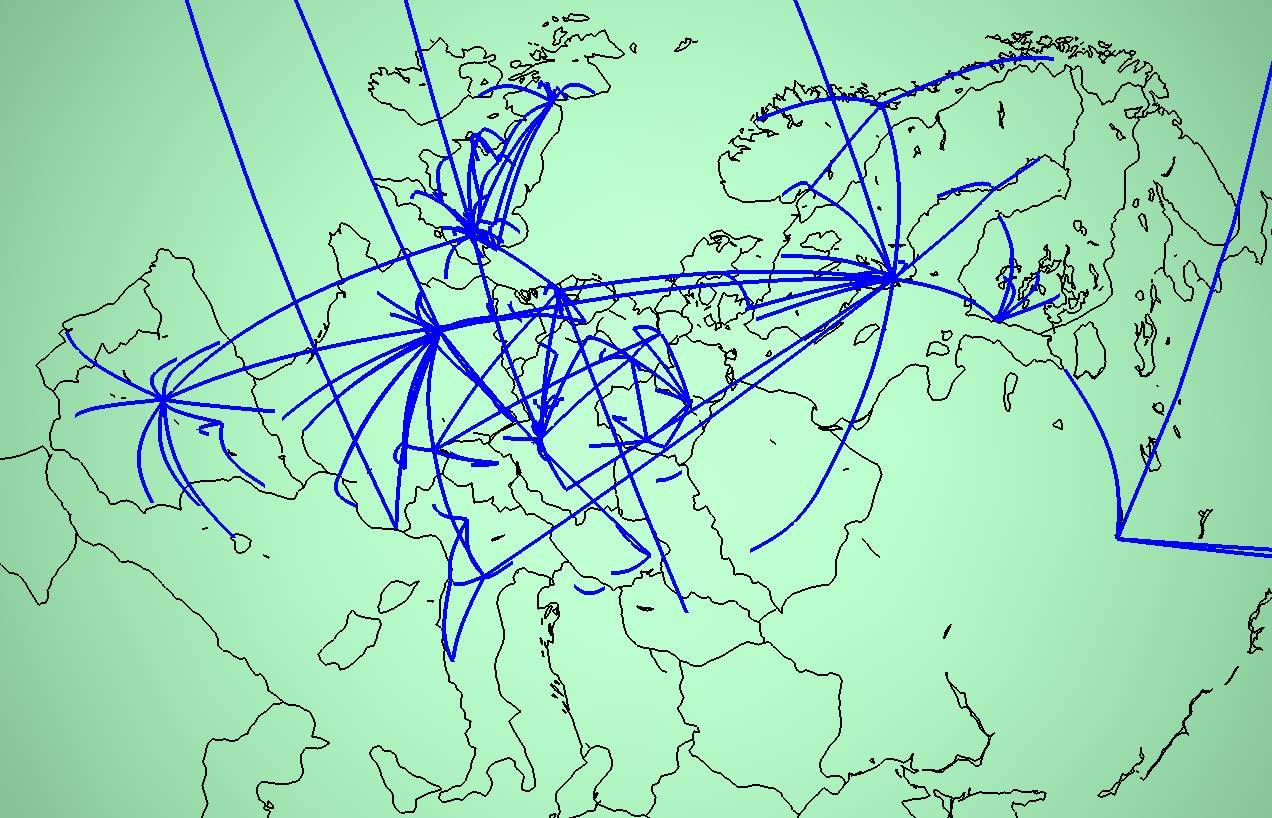
| Topology | Info Maps | Info Landscapes | Info Spaces | ISP Maps | Web Site Maps | Surf Maps | Historical ] |

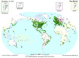
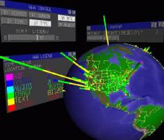
| The Palantir WWW traffic visualisation application developed by Nektarios Papadakakis, Evangelos P. Markatos and Athanasios E. Papathanasiou at the Institute of Computer Science (ICS), Foundation for Research & Technology - Hellas (FORTH), Crete. |
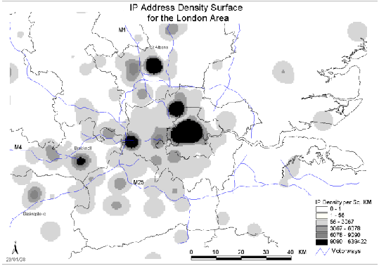
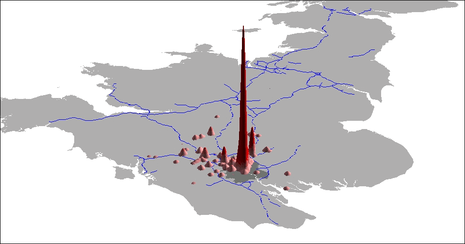
Analysing the Geography of Internet Address Space, research by Martin Dodge and Narushige Shiode in the geography of ownership of blocks of Internet (IP) addresses in the United Kingdom. |
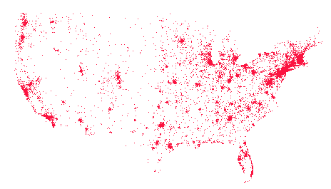
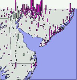
A map of the registration location of Internet domain names in the USA and a 3D view of the density of domain names registered in the state of Delaware. These maps were produced by Internet.Org
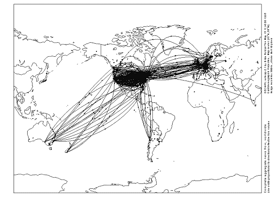
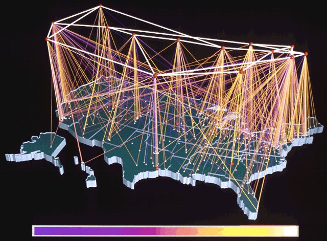
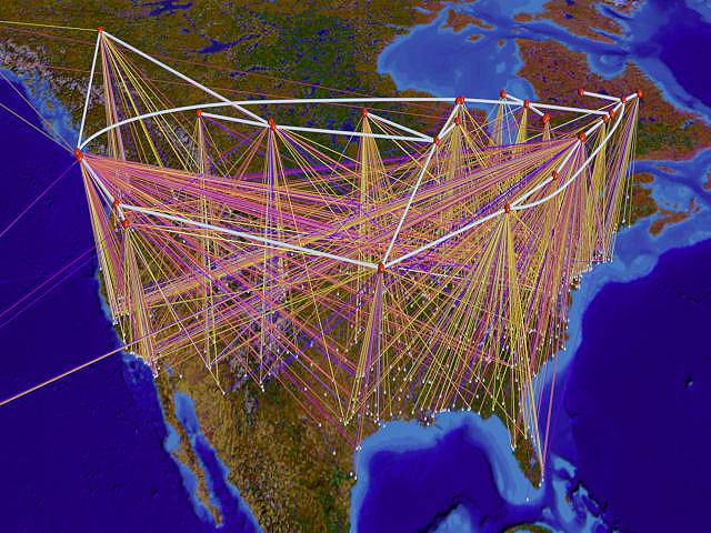
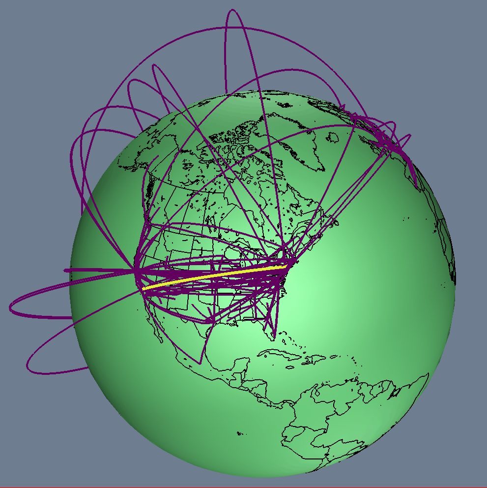
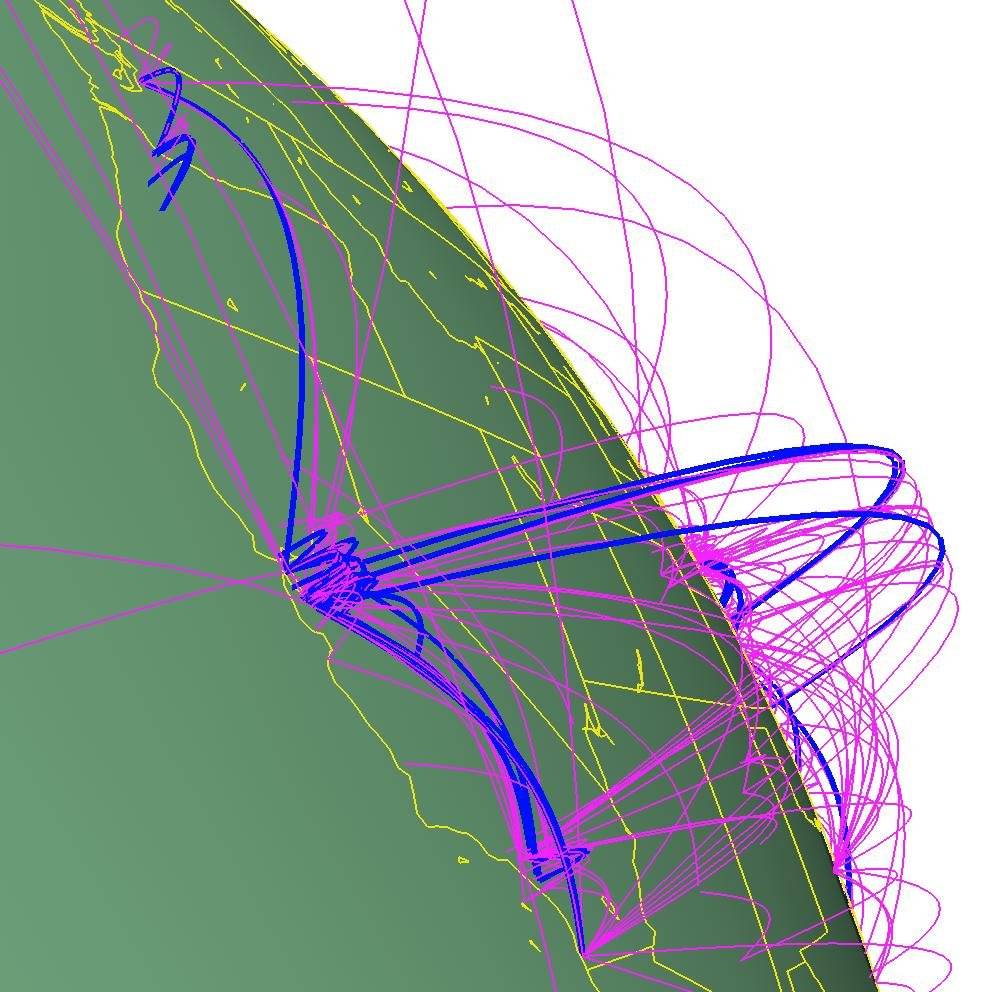
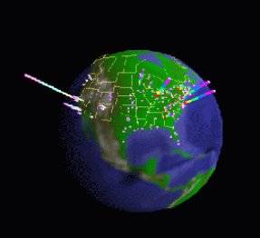
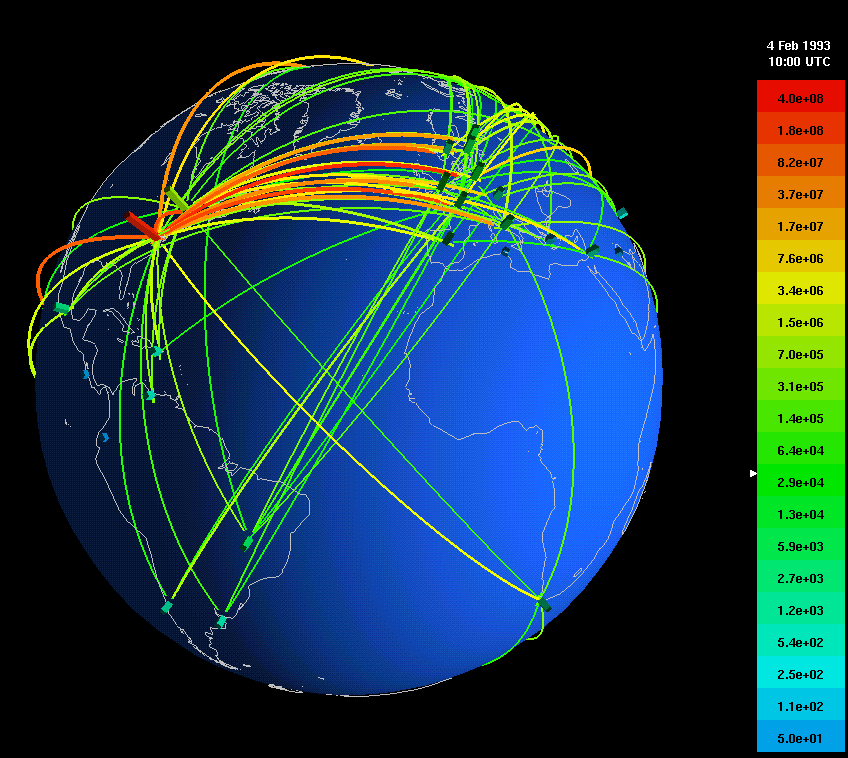
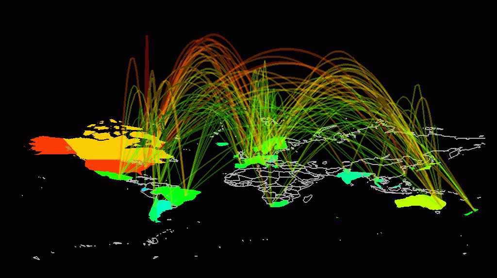
| Two examples of the research work ofStephen G. Eick and colleagues at Bell Laboratories into the visualization and analysis of Internet traffic flows. See his Network Visualization Gallery for many other fascinating images. |
 |
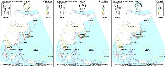
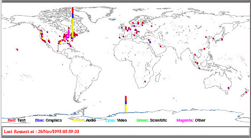
WebHopper, an experimental mapping of Internet traffic in real-time developed by Sensorium.
[ Introduction
| Conceptual
| Artistic
|  Geographic
| Cables & Satellites
| Traceroutes
| Census
Geographic
| Cables & Satellites
| Traceroutes
| Census
| Topology
| Info Maps
| Info Landscapes
| Info Spaces
| ISP Maps
| Web Site Maps
| Surf Maps
| Historical
]
| Topology | Info Maps | Info Landscapes | Info Spaces | ISP Maps | Web Site Maps | Surf Maps | Historical ]