|
|
Census and Statistical Maps of Cyberspaces

|
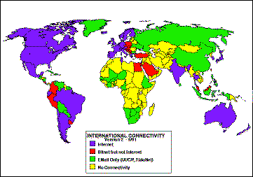
A "census" of Internet connectivity by countries has been undertaken at regular intervals byLarry Landweber, Computer Science Department, University of Wisconsin - Madison, USA. The map opposite shows the differential levels of network connectivity in September 1991.
|
|
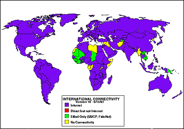
The map on the left shows the connectivity position in June 1997. The change in connectivity levels is clearly evident, showing the spread of the Internet.
Larry Landweber's maps and data tables are available from
ftp://ftp.cs.wisc.edu/
connectivity_table/
|
|

|
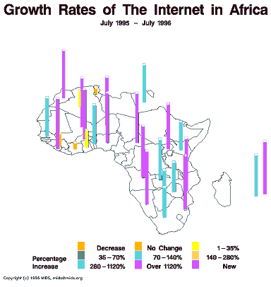
An example of the statistical maps of the Internet produced by Matrix Internet & Directory Services (MIDS).
|
|
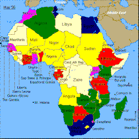
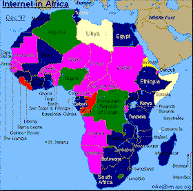
Mike Jensen is tracking the growth and development of the Internet in Africa, including producing a range of statstical maps and graphs. The two maps above show the changing level of Internet access and international bandwidth between may 1996 and december 1997.
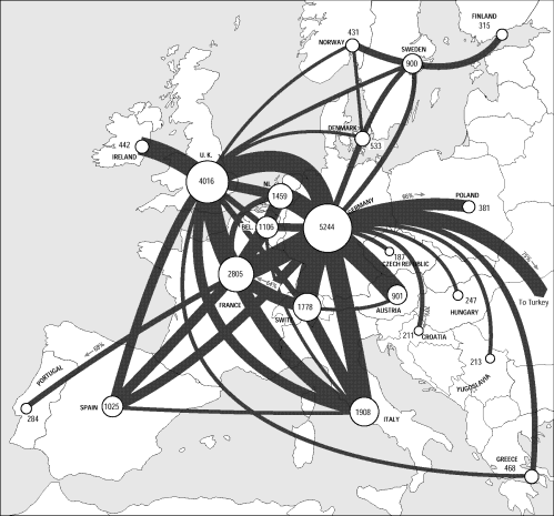
An example of the statistical maps produced by TeleGeography, Inc.
This one shows European telecommunications traffic flows in 1995.
|
|